The power of data is in being able to make sense of it. Sometimes however, under the enormity of data, the best of systems can throw a challenge in aiding the right decision. Hence there is a need for a comprehensive visual component to complement existing systems, which would allow the absorption of large amounts of data in a presentable format. Thus is an effort by IFMR Rural Finance team in collaboration with CDF to add a geospatial dimension to the existing MIS.
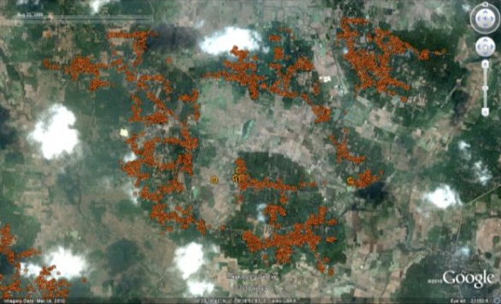
The new system aims to feed in the enormous amounts of data of KGFS customers and presents their details in a visual format laid across over an interactive Google map. With seamless integration with the existing databases of KGFS, the system would provide real time and most immediate information on the dot.
Some salient features of the Geographic Information System are:
- Ability to perform basic descriptive analysis (count, mean, variance, etc) on the map at the macro level
- Answering queries across various parameters. For eg. Transaction frequency of customers in a particular village, Loan Outstanding (<5K, 5-10K, 10-15, etc.) village-wise, insurance customers with 2 KM radius from branch location, non-customers in hilly regions over X feet above mean sea level, etc.
- Ability to drill down to the customer / transaction level
Being developed with the help of open source tools like Google Maps API, PostGIS and MapServer, the power of the system would be made available to every constituent of KGFS from the Wealth Manager to the CEO. Access to some features would also be made available on the public website of IFMR Rural Finance.
Early snapshot of the system showing the Karambayam Branch Service Area:

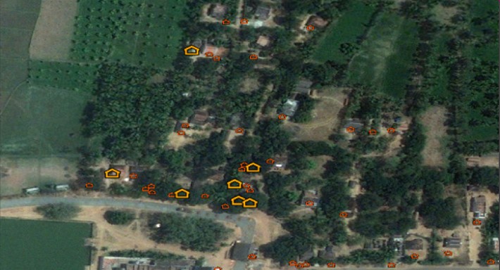
Zoomed-in map showing a smaller area

Ajay Karthik and Amit Shah who are involved in the development of the system say, “The visual representation of information on the map is expected to be more intuitive and hence at least one notch above the most powerful MIS. The system will help in providing insights into geographical gaps in the market / service area. It is also expected to help in taking decisions on branch locations, optimisation of distance from HQ / service area from a logistics point of view.”
Watch this space for more updates while the system is being developed.


6 Responses
This is Great. Congrats Amit and Ajay!
This is Great. Congrats Amit and Ajay!
Fabulous idea! Look forward to hearing more on this front.
Fabulous idea! Look forward to hearing more on this front.
This is enormous and all way’s unique from other.
This is enormous and all way’s unique from other.