
This post is a follow-up to our earlier post which briefed about the mapping exercise that IFMR Rural Finance had undertaken to study the service area of a KGFS Branch.
Once a location to set up a KGFS entity was identified, (Krishnagiri district in this case), team members Shilpa Bhaskar, Gayathri Vijayaraghavan and Noble Joseph of IFMR Rural Finance put in place a field team to survey the entire district first hand.
The surveyors mapped the infrastructure details (as mentioned in the earlier post) using an open source application that was customised on the mobile platform for this specific purpose. By switching from traditional paper-based survey to electronic format, the team straight away was able to act upon its findings. For example, every detail geo-tagged on the mobile was updated live and it was easy to track the surveyor real-time throughout the day. This close monitoring in-turn reduced data errors drastically.
This data was then coded on to the mapping application.
In addition to the general infrastructure details of the village, the team also mapped every household in the village for enrolment. Once again, each household was coded to show up on maps.
At any point of time, it became possible to see the list of households that had enrolled with the KGFS entity and the ones that had not, giving valuable spatial perspective to the decision makers in the KGFS entity.
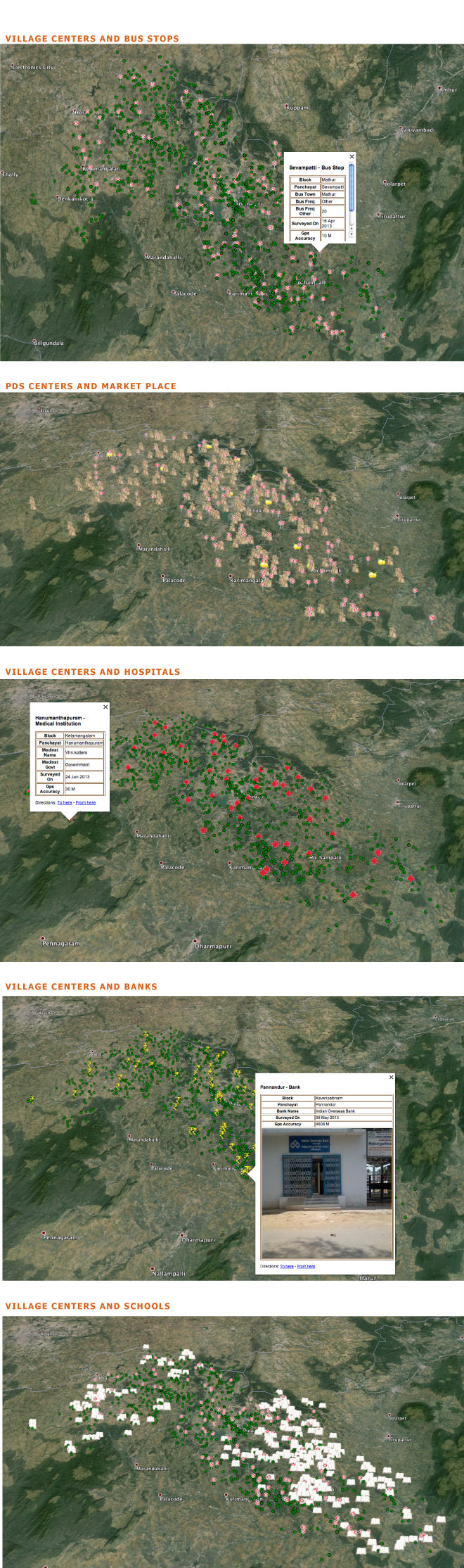
A mapped district. (Graphics by Rohini Rajavel)
The potential use of this visual interpretation of data is immensely varied and powerful. Some of them could be:
- By mapping the infrastructure details, it is possible to sense what locations are at the brink of urbanisation and thus adjust the KGFS branch location to suit its Remote Rural criteria.
- The geographical spread of a particular product take-up gives valuable information about the economic activities in that area. For example, a cluster of households in a specific area availing livestock loan could mean a thriving dairy economy in that area and so further suitable products can be recommended to the customers from there.
- The data captured is a rich source of inputs to help design the right products for a geographical location. For example, an area with a large number of retail shops would be a valuable input to the product design team who can then design a very specific set of products for these retailers.
- Households can be followed up for enrolment on a regular basis; areas with least enrolments can have a more intense awareness campaign.
- The wealth manager (field staff) can plan his/her day efficiently.
The entire exercise took about 3 months to complete, but by the end of it, the data on hand proves to be very valuable that could help organisations like KGFS entities to create lasting positive impact on the economy of the villages.